Showing posts with label Charity Ride. Show all posts

Wednesday, September 17, 2014

2014 Preservation Ride

For the 3rd year now, Upstate Forever hosted the annual Preservation Ride.  This is a major fundraiser for the organization, which uses the funds to "promote sensible growth and protect special places in the Upstate region of South Carolina." 

I've been blessed enough to be able to attend all of the events to date.  After riding both the (then) 75-mile route in 2012 and the 40-mile route last year, I already had an idea of the course and the challenges that I would face.  I have not attempted the major climb on the long route since the inaugural event in 2012, so I was anxious to see how I would fare versus my 2 year younger self.  What I couldn't anticipate were several factors that made this a year that testing myself against Skyuka was not going to be in the cards.

There were several factors that I could have controlled, and a few that I couldn't.  Weather was predicted to be wet by late morning, so I knew that it was going to be dicey trying to navigate the descent from the climb.  I also had started coming down with either allergies or a cold, which was limiting my ability to breathe.  As the ride started, I figured that I would just have to see how I felt when I got to the bypass, and see if it was worth attempting.  I told myself it would depend on the group, and I'd probably be swayed by the decision that was made when we got there.  

The group for the long route was smaller this year than it had been in 2012 (the long route starts an hour before the 20- and 40-mile route), and it quickly split into two different groups.  As it would have it, I found myself in the front group, and doing pretty well.  Unfortunately my heart rate monitor was not working properly (I'd get it fixed by about the halfway point - helps to have all the parts to the strap attached), so I didn't realize just how much effort I was putting into staying with this fast group.  The new Soma Smoothie was performing great, and I was happy to be hanging on (and even taking a turn or two pulling) as we moved along.  We skipped the first rest area, as most of us had plenty of fluids being so early in the ride (we got to the first rest area less than an hour after the start). 

The issue was that the effort was really more than I should have been putting out early, and I paid for it before getting to Tryon.  About 25mi into the route I knew I needed to back off, as I wasn't feeling very well.  I had figured that another group would be only a few minutes behind us, which had a few other folks that I'm used to riding with.  If I just backed off some I'd be picked up by them was my logic.  What it ended up is that we had put in at least 15 minutes (maybe close to 30) on the second group very quickly.  At this point I was pretty much riding on my own.  To compound issues, one of the hardest climbs in the ride was coming up - New Market Road.  This road is notoriously hard, to the point of having a message spray painted onto the tarmac stating to get into a low gear.  I downshifted, but not enough, and once you hit 20%+ grades I know better than to attempt to shift any further, so I was down to standing.  About 3/4 of the way up the grunt, I just couldn't turn the pedals, and that cold I was fighting started to win;  I had to get off the bike.  Walking the bike up a hill is not something that I'm accustomed to, but it was apparent that trying to start back up on that steep of a hill wasn't going to be practical.  It was only a short distance before the main grunt subsided, and I was able to get back on the bike and keep moving.  It did give me a good indication that trying to climb Skyuka would be challenging today.

Making my way to the second rest stop, I was still riding solo.  The main group wasn't too far ahead of me, from what I was told by the woman working the stop, but the weather was not looking all that inviting.  Looking down the road towards Skyuka, the mountain itself was covered by clouds.  I started to worry that the descent was going to be wet, and trying to navigate it by myself was going to be difficult at best.  I opted at that point to do the bypass, which cut about 6 miles off the route, but was still a very pretty travel route.  I don't fully regret not attempting Skyuka, as I wouldn't typically experience this road otherwise.

The third rest area was being staffed by my family, which I have to say is always an awesome experience.  It happened to be my youngest's birthday, and the fact that she was willing (and happy) to be helping the riders with water and snacks really made me proud.  I actually surprised them by being the first person to ride up to their stop, which surprised me as well.  I took the opportunity to take another long break, figuring that maybe I could meet back up with the front group and not have to ride solo the rest of the way.  After hanging around for about 15 minutes I had to move on or risk not having any real energy for the back half of the route.  I didn't hurry through the next section, as I kept hoping that the lead group would move through and I'd be able to latch on.  It also gave me the opportunity to take a few shots as I rode through the Greenspace of Fairview, a privately held property protected by Upstate Forever.  To me, this loop is the gem of the ride.  


The last of the rest stops is housed in one of the barns on the property, and I took another few minutes there to take a break, relax, and hope that one of the other groups would come through.  After spending time chatting with the folks working the aid station and taking a few more pictures, I started back on the road when I saw some folks ride through.  I was hopeful that maybe I could hang on with them for a while.


As it turns out, the group that came by was a couple of the really fast folks.  I hung with them for a little while, about 12 miles, but then ended up having to let them ride off as I knew that I couldn't hold with them all the way to the finish.  


The final leg of the trip was through more farmland, and outside of the need for a rest stop around mile 60-65 was fantastic.  The weather started to get warm, so I was glad I took the time at the final rest stop to make sure that I had plenty of fluids.  One of the folks from the front came past me close to the end and had missed the final rest stop, and thus was out of water.  I had extra that that point, knowing we only had a few more miles to go, so I gladly shared.  It wasn't long before the telltale climb to the red barn was in sight.  At the finish a meal was provided that included chicken, pasta, salad, and several desserts.  In keeping with the spirit of Upstate Forever, the meal was served on stoneware that can be washed and reused.  


While the 2014 running of the Preservation Ride didn't include Skyuka Mountain Road for me, it was still an extremely enjoyable experience.  The scenery showcases how beautiful upstate South Carolina is, and the ride is challenging and fun.  Each year they improve the route to accommodate the requests of the riders, and it's awesome to see how it has evolved from the inaugural edition.  If you are looking for a great ride, you will not go wrong with the Preservation Ride each year.  While it isn't a "Gran Fondo" and may not have past and current professional cyclists show up and party, it is a challenging course and supports a fantastic cause.  

Thursday, June 19, 2014

2014 Ride 4 Animal Care

For the second year, TeamFS has sponsored a charity ride to benefit Animal Care, a Greenville County rescue organization that helps find pets new forever homes.  Several friends and I learned last year that this is a very challenging ride, even on the shorter 40 mile route, but a chance to ride up one of my favorite climbs in the upstate gives me reason to come back each year.


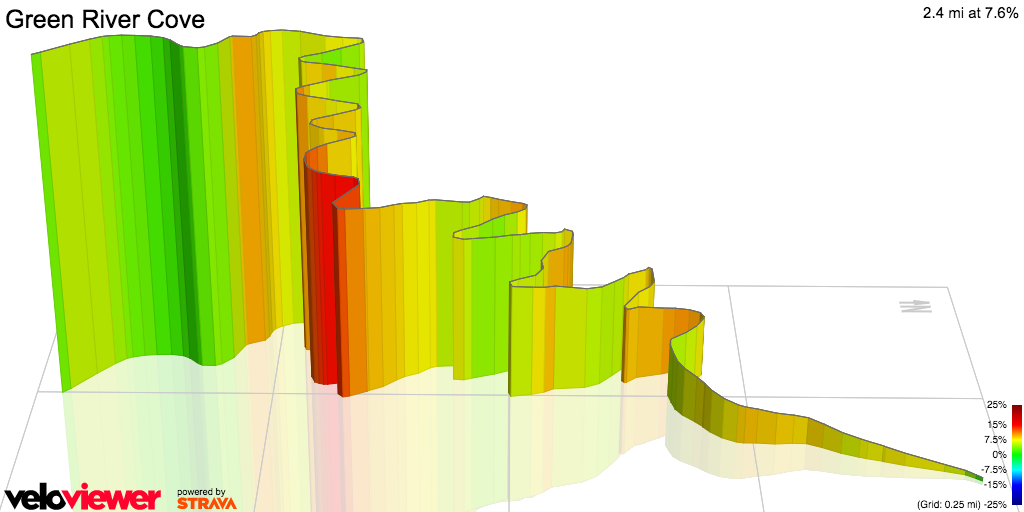
The Ride 4 Animal Care has several good climbing sections, but the main feature is a chance to climb Green River Cove.  SteepClimbs.com describes Green River Cove as "[o]ne of the toughest climbs of the area is covered by trees and has 17 tight switchbacks. "   While the climb is much shorter than some of the other local riding attractions, this one is quite well known for those 17 switchbacks.  During the summer months it can be even more challenging because the Green River is a popular tubing and kayaking spot in the upstate as well.


rendering of Green River Cove from VeloViewer.com

Before you can experience Green River Cove, you have to get there.  The ride started at the North Greenville University stadium in Tigerville, SC.  Last year we had an early climb up Callahan Mountain, but because of construction work earlier in the week, the route was changed to bypass that climb and go out Dividng Waters road toward the Greenville Watershed. Most of the riders doing the 40 and 60 mile routes were not upset over this change, as we had plenty of climbing to experience without the extra from Callahan.
At the start time the temperatures were in the mid-60's, although we all knew that this wouldn't last through the day.  As we climbed up the Greenville watershed, the sun was just starting to peek through the treelines, making for some terrific views.


views on the watershed in the morning
Once through Saluda the group I was with worked up to the rest stop where the 40 mile route split from the 60 mile route, and took a break.  One of the big things that I'm still working on with these bigger rides is taking enough of a break to recover before attempting to move on.  Once I get on the bike, I get into a zone where I really don't want to stop.  Getting a rest and recovery is vital, though.  Once I had a banana and some rest time, it was off to head down Holbert's Cove.

Holbert's cove is probably one of the most technical and challenging long stretches of road that I have ridden.  The terrain mixes in hard rollers, with gradients over 15% and hard turns.  It also affords some picturesque views that are sometimes hard to take in an enjoy.


The most technical area of Holbert's Cove is about 3/4 of the way down from Saluda, and is a rather sharp right hand turn.  I've only encountered this turn twice, the first time being during a training ride for the Assault on Mt Mitchell in 2013.  I was already aware of how technical this turn is, and that you have to be careful of your speed as you approach it.  I got myself overly concerned about speed, and didn't get prepared for making the turn, so I overshot it, but was able to correct before heading off into the trees.  I felt very lucky that there were no oncoming cars as I got myself back onto my side of the road as quickly as possible.


Once past Holbert's Cove, you get into the long stretch of mostly flat riding that follows the Green River, knowing that at the end of this stretch is the moster that is known as Green River Cove.  You pass by the river cabins, kayaking locations, and tube rental camps, all set in a rustic setting.  The river looks calm and inviting, and you can see the mountains all around you.  The temperatures in the cove had yet to break 70 degrees, so the wind felt nice.  It leads you into a false sense of security with how serene it is. 


Once you pass over the Green River for the final time, the climbing starts.  With 17 switchbacks, measuring your efforts becomes critical.  The best part for me is that these switchbacks have numbers on each turn, giving me something to focus on during the climb.  Knowing how much of an effort is left allows me to dig deeper to keep going when you really just want to stop and take a long nap.  At the top of the climb is a short ride back to the rest stop in Saluda.  It was a welcome break, and one that I made sure to actually time to make sure I rested well enough before continuing on the route.  With 20 miles left to go, I didn't want to rush through this stop and regret it later in the ride.  After having a banana and refreshing both water bottles, I was on my way.

The last 20 miles of the ride follows the same route as the 40 mile version, going down the Saluda Grade and back up Fork Creek road.  The Saluda Grade is named for the section of road that follows the steepest segment of standard grade railroad line in the United States.  The road has wide sweeping turns, and is a fun section to ride down.  The climb up Fork Creek Road isn't very technical or steep, but with recent road work was a little hazardous in dealing with gravel in the road.  Near the middle of this section there is a fork in the road, and looking at the conditions I chose to take the slightly longer route that had less visible gravel.  I was quite glad that we were traveling up this section, instead of riding down it.  


The final segement of the ride was a trip back down the watershed, and then riding back to Tigerville.  The route takes you past George Hincapie's new resort, Hotel Domistique, finishing up on Chinquapin Road.  It happens that my family was working the rest station that was located in the parking lot of the Hotel, so I made one final stop to fill up water bottles and say hello before riding back in.  

Totally 67 miles and almost 6000' of climbing, the Ride 4 Animal Care is definitely a challenging route, and one that I look forward to riding again next year.  Each year Vince and the TeamFS folks are learning how to improve the event, and I'm sure it will be even more spectacular next year.  Personally I hope that they decide to add event numbers, as they are great souvenirs, if not having an optional medal that can be given to people that complete the full 67mi event.

Friday, May 16, 2014

Hiatus

It wasn't my intention to take an almost 3 month break from posting.  It's not that I haven't been out riding, or had anything to write about, but after a few weeks of missing out on writing about a topic, I felt like I was behind, and it snowballed from there.


AOTC 2014 did not disappoint


So, in my worst announcer type voice, here is the short-short version of the past 3 months:  I've gone through several highs and lows and completed the Assault on the Carolinas, which was once again a fantastic ride.  I've dealt with another wave of mechanical issues on the bike, including being managing to taco my small chainring, and had to make the decision to drop from riding in the inaugural Beech Mountain Metric.


Even my Garmin had a mechanical... Taco... small ring.

At this point I've set my sights, training, and fundraising on the Ride to Remember this July.  It'll be the first 3-day event that I have ever attempted, and it encompasses over 240mi of riding.  The fundraising benefits the Alzheimer's Association, where the funds raised are used to help Alzheimer's research, care, and support of the over 5 million Americans suffering from Alzheimer's currently.

Personal life also required more attention during the past few months, and I've had several lower than average volume weeks as a result.  With only 9 weeks left until the Ride to Remember, though, I feel like I'm on track.  In fact, I'm looking forward to giving a recap of the Skratch Labs Stage Race Challenge on Strava which I'm using as a dry run of what to expect in July.  With only 6 hours of riding left to complete the challenge, I feel like it is really putting me to the test.

Monday, September 16, 2013

2nd Annual Preservation Ride

Saturday September 14th was the 2nd Annual Preservation Ride to benefit Upstate Forever.  Upstate Forever is a non-profit organization that is focused on keeping areas of the Carolinas pristine for future generations.  They have worked on projects to protect land areas, helping to establish the Greenspace at Fairview, to being one of the backers of the GHS Swamp Rabbit Trail.  Last year I had the pleasure to ride the 75-mile route as a part of the inaugural event, and I have been looking forward to riding again this year.  Due to unforeseen circumstances I wasn't able to ride the long route and take on Skyuka Mountain Road again, which is definitely one of the most challenging climbs I've done in my short cycling career, I was able to get in the 40 mile route.  This turns out to be no cake run, either, but the views are just about second to none.  


The day started out early, and as if on queue the weather was perfect.  The 40-mile route didn't start until 9am, but a few of us got there early to take a quick warm up lap around Strawberry Hill USA, just outside of Chesnee SC.  There was still a bit of chill in the air, and getting warmed up took a bit of effort.


After completing the loop, it was just about time for the mass start of the 40mi folks.  The start and finish line for the Preservation ride is the main cafe at Strawberry Hill USA.  As we got together to ride out, we got instructions from Steve Baker about the route, and then we were on our way.  


The thing that is unique about this ride, is that you spend so much time enjoying the scenery instead of spending time getting to someplace interesting.  The sky was so crystal clear, and we were out in the country literally 200 feet after we started.  Miles just melted past, and we had a chance to chat with various riders as we went along.  In the first 15 miles there were only a handful of moderately steep hills to contend with, and it felt like we were going downhill most of the time.


At about the 18 mile mark we reached the first rest stop, and learned that they had added a ~3mile loop inside of Greenspace at Fairview to make sure that the ride got closer to the 40 mile mark after some changes in the route from last year.  This area is a reserved area that Upstate Forever worked with the home owners in the area to create, making an easement where the natural beauty of the area will be preserved for future generations.  There was a lot of open countryside, with horse stables (including several folks taking their horses out for walks) and natural woodland spaces.  We decided to take the loop before making a stop, enjoying the scenery the entire way.  We spent most of this time gazing at the mountains off in the distance, tempting us to continue the journey, like sirens calling out to be explored.


The rest area was bustling when we got there, as folks were stopping either before or after they had completed the loop. After getting a chance to rest our legs and refill out water bottles, we decided that we wanted to ride the loop another time before we started the bottom half of the ride. Instead of just riding the route as marked, though, we decided it would be more fun if we went the other direction around the loop. We were not disappointed, as the ride in reverse gave us more fantastic views of the mountains, and gave us a chance to see more of the countryside as we went around. I would highly recommend to folks doing this ride next year that they take on doing the loop twice to get closer to 40 miles and get just a little more time to enjoy the area.


The second half of the ride brought us more challenges as we dealt with returning back into more populated areas as well as experiences several longer rolling hills.  We made our way over Lake Bowen and through the countryside around Boiling Springs, SC.  The only high traffic area of the ride was while we were on Highway 9 for about a mile.  While there was an established bicycle lane, it was overgrown and had a fair amount of trash that was in it, making it a bit dangerous to stay out of the way of the vehicles.  Thankfully this was an extremely short section of the ride, and we were back out into the country.  As we rode back towards the start/finish point, the rolling hills just continued to challenge us.  As we'd crest one hill we'd be presented with a decent and another climb yet to come.  One of the folks I was riding with exclaimed "they just keep coming!".  

We passed several photographers along the way, taking pictures of the riders.  For a couple of them I decided to ham it up and act like I was sprinting for all I was worth, but for the most part I took the time to sit up and wave, as I was enjoying the ride more than anything else at this point.  I felt like I could have just kept riding for hours longer, taking in the day and the beauty around us.  

We took our final left hand turn, and the strikingly red roof of the cafe at Strawberry Hill USA came into view at the top of the next climb.  Just before this point I had made a comment to Mark that last year I had made a promise to sprint out the last leg of the ride.  Much like last year, the final climb of the ride took its toll on my legs, and I used the last bit of energy I had left to make a good showing as we went by the corn maze.  My family was there to greet us, and we were greeted to a fantastic lunch.  Unlike most rides, the lunch was served on actual plates, with cloth napkins and real silverware.  This left the waste to be minimal.


Of all the rides I've experienced in the past 2 years, this has to be one of my favorites.  From the organization that it supports to the views that you can experience, it's one of the best in the area.  The routes are well marked and well supported, and it definitely is as challenging of an experience as you make it.  Having now done both the 40 and 75 mile routes, neither disappoint.  I find it challenging to ask folks to help fund raise for many of the cycling events out there, but Upstate Forever does directly for the area that I have less of a heartache with it.  I look forward to when the 2014 edition of this ride is announced, and getting a chance to challenge Skyuka Mountain road again.


Sunday, June 2, 2013

Ride 4 Animal Care

Preface:  This is going to be a rather difficult ride recap for me this time around, as one of the folks that we were riding with ended up having to go to the Hospital instead of making it back to the starting area safely.  It's difficult for me to be upbeat about a ride the ride, and to say that I thoroughly enjoyed it when I'm still struggling internally with the memory of watching another cyclist, especially someone that I know, go down and not be able to continue.  I still have her in my prayers today, and I have a lot of things to re-evaluate in my own personal riding after having to be a supportive friend to her while EMS were attending to her wounds.  

The day started out relatively cool, but you could tell that as the sun finished coming up it was going to be a warm day.  I was a bit shocked to see the number of folks that had signed up to ride in the event, which was a charity ride for Animal Care - a local rescue organization that also provides assistance to animal owners for discounted veterinary care.  I haven't heard the exact numbers, but I would guess there were between 150 and 200 people that showed up to ride.  Having the ride start at 7:30am was a good choice, as we'd be done before the relatively warm heat of the day got going.  


More folks at the start than I was expecting
There were three rides organized:  20, 43, and 67 miles.  The highlight of the big ride was Green River Cove, which is a challenging stretch that includes more than a dozen switchbacks.  I have riden that section of road a few times, but never when it is technically in season for the tubing and kayaking people.  While I signed up for the big ride, I hadn't fully decided if I would take that route as the trip down Holbert's Cove to Green River Road is not an easy section.  Secondly, this would be the first real test of my knee since the Assault on Mount Mitchell.  Lastly, several of my friends that I ride with out of Brookwood on Sundays had signed up to ride.  I enjoy riding with friends more than just going on a route, so I had already been swayed to just do the shorter route and enjoy myself.  I figured I could make my final decision at the point where the 43 and 67 rides diverged later in the route.


Ken had a feeling that he forgot something...


The first surprise to me was that we were actually climbing Calahan Mountain.  When I had reviewed the route online, I didn't catch that we weren't taking Dividing Waters all the way to the watershed, but instead would do the ~1mi climb.  While the climb isn't very long, it definitely is more challenging than many people might realize.  I personally had never gone this way to climb Calahan, and it is a challenging approach.  The bonus here is that the descent is awesome, and if you know where to stop you can see the historic Poinsett Bridge.  I missed the place to stop, just one of my navigation errors of the day, so we ended up regrouping at the first rest stop which was placed at the start of the climb up the watershed.


Poinsett Bridge from Jan 2013
After regrouping, we rode together up the stretch of Old Highway 25 known as the watershed.  This is a 6-7 mile trek at a relatively low pitch to get to the NC/SC state line heading towards Saluda.  It's one of the first "real" climbs that I did last year and one that I enjoy riding when I can, especially with friends.  We made it up to Saluda, NC and stopped at the second rest stop without any incidents.  By this time I had already convinced myself that I didn't really want to attempt Holbert's Cove, mostly because I was enjoying riding with friends.  I have been training so much this year that I feel like I've missed out on adventures like this a bit.  


The view from Saluda was fantastic
The ride started getting a little more interesting after Saluda.  The route took us down what is known as the "Saluda Grade", which is a 2 mile segment that has nice long sweeping curves that is a real joy to descend.  Typically I feel like I can let loose on this section, and enjoy some speed.  This time, however, in one of the left hand curves I got too close to the edge of the road and had to make a very quick decision.  I wasn't turning fast enough to potentially stay on the road, and there was a large grassy median to my right.  I was either going to have to attempt to cut harder to stay on the asphalt, or I was going to have to attempt to navigate offroad.  I chose the softer grass to the harsh asphalt as my potential landing area, and went into the median.  I was told that I looked fantastic as I rode through the grass, coming to a stop further down the curve, but I think I'm glad that I do not have video evidence of that little endeavor.  It definitely got my adrenaline flowing, and I didn't have any issues finishing the descent, but it definitely was the first of the eye openers for me on this day.  

We made it down to the bottom of the grade, and regrouped.  This was another tricky area, as there was a lot of gravel on the ground near the turn off.  Enough gravel that Ken even decided to go past the turn and loop around to avoid having to take a higher speed turn into it.  The next section really was the interesting climb of the day - Fork Creek Road.  This is the section that I wrote about a few months ago where we were passed by a truck in one of the curves that really was a bit nerve wrecking.  I hadn't gone up this section since that incident, so I was a little on the lookout for cars behaving badly as we rode along.  What was awesome is that we were going at a pace where I could enjoy a lot of the littler things as we went, including some great views and sounds of a stream a fair ways below us.  This climb is a great primer for Ceaser's Head, and we were all attempting to get Kimberly's confidence up for a trip over that way later this summer.  From the turn off on Pearson's Falls Road to the top of Fork Creek is approximately 7 miles, and while it's not quite as much climbing as Ceaser's Head, it's one of the few places where you have that length of climb to get a feel for just sitting in the saddle.

At the top of the main part of the climb is a good place to regroup again, so we made sure we were together and continued on Fork Creek.  It wasn't more than a mile later that Sheila ended up crashing.  I was far enough behind her that the actual incident is a bit of a blur, but if I close my eyes I can still see her falling.  She ended up hitting the pavement hard.  We all rolled up, and she was sitting there, definitely in shock and also in a lot of pain.  She stated that her hip hurt a lot, and her wrist definitely looked injured.  We urged her to stay seated while we gathered up the items that went flying (water bottles, cell phone, etc) and called for medical attention.  The issue we had was that the cellular reception up in the mountains was not good.  The SAG truck showed up, and between the 5 of us we managed to get enough cellular signal to get EMS dispatched.  The ride coordinator also showed up and we helped get an accident report filled out.  It took a little while for the Ambulance to show up, and after tending to her wrist they put her on a stretcher to bring her to the Hospital.  All in All we sat there with her for over an hour, and I am amazed at how strong she was through the whole ordeal.  We got her car keys and loaded her bike up on the SAG truck to bring back to the start, and we told her that we'd take care of making sure to contact folks and get her car back to her house safely.  


Not the people you want to meet on a bicycle ride
We got back on the road with heavy hearts, and went to complete the ride.  The section of Fork Creek and Mine mountain that we had left to go was difficult both because we were saddened by the accident and because we had taken the hour off the bike in middle.  We ended up having a little dog that had wandered over during the event keep us company for a few miles, running along side us and being our mascot.  It was cute, but Sam had to be careful when she decided to change directions quickly and almost met up with his front wheel.  We made it back to Mountain Page Road without any additional incidents, and started out way down the Watershed.  


Typically going down the watershed is a point where you let loose and really pick up a lot of speed.  This section of road is not technical, nor steep, so you can really have a lot of fun.  This day, however, we took it much more calm than I think I've ever taken it, being overly cautious as we went.  We stopped at the rest area in front of George Hincapie's "Le Domestique" resort, and refilled our water bottles for the rest of the ride.   The ensuing section is a nice distance on Chinquapin Road, back to Tigerville.  We continued the trend of being overly cautious and making sure to stay together well.   

After we got back to the start, I changed clothes quickly so Ken and I could get Sheila's bike and car back to her house.  Ken followed me in his car so he could give me a ride back to get my vehicle.  It made for a much longer day than I intended, not leaving Tigerville until mid-afternoon, but I would have traded many more hours than that to be able to say we all made it back safely.   I found out later that Sheila was going to have to have surgery that evening to repair her hip and her wrist.   I continue to keep her in my prayers.

The important lesson that we all got given today is how much we need to be careful when  out riding.  I fee terrible that there isn't more that I can do to help her at this point, but even with knowing the route I couldn't have predicted that accident.  We all know that there are risks involved with cycling, but unfortunately too often it takes situations like these to remind us that we are mortal.  I'm joyful that Sheila will recover, and I'm joyful that my off-road experience didn't end in disaster.  I can tell that this day is going to live with me for a while, and that my downhill speed will definitely be slower.  I hope it's not a lesson that I ever have to re-learn.